Property Record
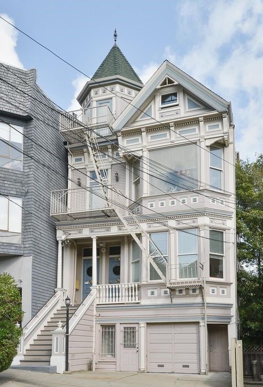
226 Grattan St, San Francisco, CA 94117


NEARBY LISTINGS FOR SALE OR LEASE
Property Detail
226 Grattan St
San Francisco-San Mateo-Redwood City, CA
Meyers Garden
1276-002
San Francisco
Apartment
California
2024
2
2025
0.07 AC
017102
Cole Valley
4,717 SF
San Francisco
DEMOGRAPHICS near 226 Grattan St
1 mile
3 mile
5 mile
2024 Total Population
58,312
552,964
832,790
2029 Population
54,148
512,737
770,468
Pop Growth 2024-2029
(7.14%)
(7.27%)
(7.48%)
Average Age
41
43
42
2024 Total Households
25,917
245,323
348,836
HH Growth 2024-2029
(7.72%)
(7.74%)
(7.82%)
Median Household Inc
$167,472
$132,295
$124,537
Avg Household Size
2.10
2.10
2.20
2024 Avg HH Vehicles
1.00
1.00
1.00
Median Home Value
$1,113,814
$1,110,719
$1,095,411
Median Year Built
1947
1948
1949
Nearby Places
Map Layers
Map Styles
 Street
 Aerial
Transit
 Traffic
 Biking
Places
Listings with unknown addresses are not visible on the map
- Restaurants
- Banks
- Shops
- Fitness
- Groceries
PUBLIC TRANSPORTATION
TRANSIT/SUBWAY
Carl and Stanyan (N Judah - San Francisco Municipal Railway (MUNI Metro))
Drive
Walk
Distance
Carl and Stanyan (N Judah - San Francisco Municipal Railway (MUNI Metro))
0 min
3 min
0.2 mi
Carl and Cole (N Judah - San Francisco Municipal Railway (MUNI Metro))
Drive
Walk
Distance
Carl and Cole (N Judah - San Francisco Municipal Railway (MUNI Metro))
1 min
5 min
0.3 mi
Carl Street and Hillway Avenue (N Judah - San Francisco Municipal Railway (MUNI Metro))
Drive
Walk
Distance
Carl Street and Hillway Avenue (N Judah - San Francisco Municipal Railway (MUNI Metro))
1 min
7 min
0.4 mi
UCSF (N Judah - San Francisco Municipal Railway (MUNI Metro))
Drive
Walk
Distance
UCSF (N Judah - San Francisco Municipal Railway (MUNI Metro))
2 min
10 min
0.5 mi
Irving and 4th Avenue (N Judah - San Francisco Municipal Railway (MUNI Metro))
Drive
Walk
Distance
Irving and 4th Avenue (N Judah - San Francisco Municipal Railway (MUNI Metro))
2 min
12 min
0.6 mi
COMMUTER RAIL
San Francisco 4th & King (Caltrain - Caltrain (Caltrain))
Drive
Walk
Distance
San Francisco 4th & King (Caltrain - Caltrain (Caltrain))
10 min
3.9 mi
Drive
Walk
Distance
10 min
4.0 mi
AIRPORT
San Francisco International
Drive
Walk
Distance
San Francisco International
26 min
15.4 mi
Metro Oakland International
Drive
Walk
Distance
Metro Oakland International
37 min
22.9 mi
Norman Y Mineta San Jose International
Drive
Walk
Distance
Norman Y Mineta San Jose International
62 min
47.0 mi
Nearby Properties
Address
Land Use
TOTAL SIZE
Lot Size
Zoning
Address
Land Use
TOTAL SIZE
Lot Size
Zoning
1,015,000 SF
2.43 AC
RC4
Address
Land Use
TOTAL SIZE
Lot Size
Zoning
248,303 SF
4.35 AC
Address
Land Use
TOTAL SIZE
Lot Size
Zoning
717,234 SF
3.47 AC
UMU
Address
Land Use
TOTAL SIZE
Lot Size
Zoning
266,143 SF
4 AC
C-3-R
Address
Land Use
TOTAL SIZE
Lot Size
Zoning
508,714 SF
1.29 AC
C3R
Address
Land Use
TOTAL SIZE
Lot Size
Zoning
696,431 SF
0.97 AC
C3G
Address
Land Use
TOTAL SIZE
Lot Size
Zoning
1.52 AC
C3G
Address
Land Use
TOTAL SIZE
Lot Size
Zoning
1,424,230 SF
2.60 AC
C3G
Address
Land Use
TOTAL SIZE
Lot Size
Zoning
263,640 SF
0.72 AC
C3R
Address
Land Use
TOTAL SIZE
Lot Size
Zoning
2.74 AC
Address
Land Use
TOTAL SIZE
Lot Size
Zoning
313,306 SF
1.23 AC
WMUG
Address
Land Use
TOTAL SIZE
Lot Size
Zoning
922,758 SF
1.94 AC
C3R
Address
Land Use
TOTAL SIZE
Lot Size
Zoning
393,918 SF
3.36 AC
WMUG
Address
Land Use
TOTAL SIZE
Lot Size
Zoning
24.37 AC
Address
Land Use
TOTAL SIZE
Lot Size
Zoning
674,317 SF
3.36 AC
UMU
Address
Land Use
TOTAL SIZE
Lot Size
Zoning
649,376 SF
0.93 AC
C3S
Address
Land Use
TOTAL SIZE
Lot Size
Zoning
2.93 AC
Address
Land Use
TOTAL SIZE
Lot Size
Zoning
342,727 SF
1.36 AC
C3G
Address
Land Use
TOTAL SIZE
Lot Size
Zoning
411,904 SF
21.74 AC
C2
Address
Land Use
TOTAL SIZE
Lot Size
Zoning
291,522 SF
6.66 AC
CM
Address
Land Use
TOTAL SIZE
Lot Size
Zoning
610,645 SF
0.82 AC
C3R
Address
Land Use
TOTAL SIZE
Lot Size
Zoning
718 SF
18.55 AC
RH2
Address
Land Use
TOTAL SIZE
Lot Size
Zoning
243,612 SF
1.94 AC
Address
Land Use
TOTAL SIZE
Lot Size
Zoning
345,000 SF
1.74 AC
WMUG
Address
Land Use
TOTAL SIZE
Lot Size
Zoning
804,136 SF
2.60 AC
RM4
Address
Land Use
TOTAL SIZE
Lot Size
Zoning
564,614 SF
0.90 AC
C3S
Address
Land Use
TOTAL SIZE
Lot Size
Zoning
246,069 SF
0.69 AC
Address
Land Use
TOTAL SIZE
Lot Size
Zoning
89,551 SF
0.73 AC
RC4
Address
Land Use
TOTAL SIZE
Lot Size
Zoning
332,221 SF
1.17 AC
Address
Land Use
TOTAL SIZE
Lot Size
Zoning
450,000 SF
1.07 AC
C3G
The World's #1 Commercial Real Estate Marketplace
Connect with us
© 2026 CoStar Group
The information above has been obtained from sources believed reliable. While we do not doubt its accuracy we have not verified it and make no guarantee, warranty or representation about it. It is your responsibility to independently confirm its accuracy and completeness. Any projections, opinions, assumptions, or estimates used are for example only and do not represent the current or future performance of the property. The value of this transaction to you depends on tax and other factors which should be evaluated by your tax, financial, and legal advisors. You and your advisors should conduct a careful, independent investigation of the property to determine to your satisfaction the suitability of the property for your needs.